Red Rock Canyon Las Vegas
Beyond the Neon: Hiking in Las Vegas
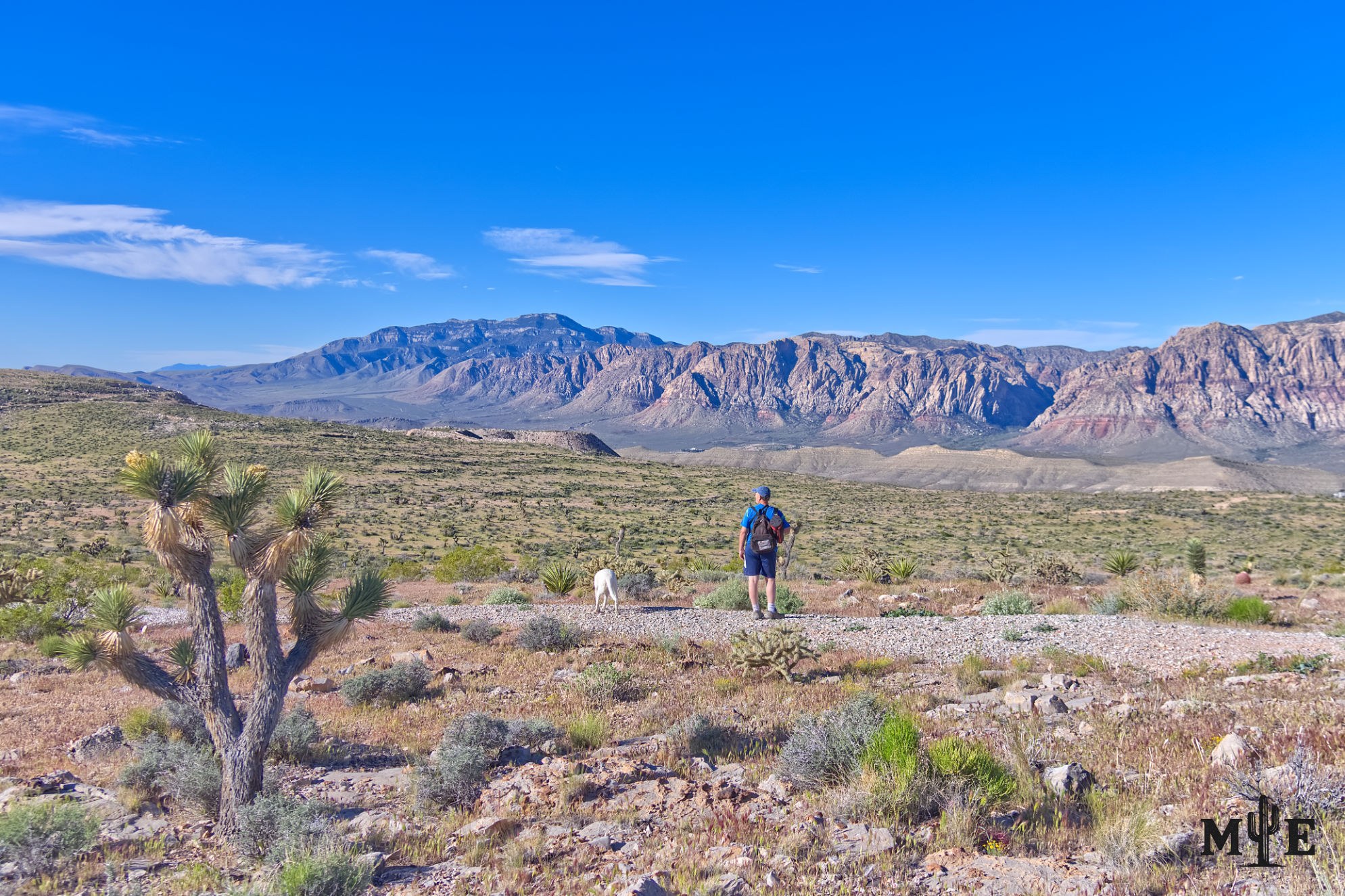
Las Vegas is usually introduced through its casinos, arenas and illuminated skyline, yet one of the region’s greatest advantages begins where the pavement thins out. Within an hour of the Strip, hikers can move from red sandstone canyons to gray limestone ridges, volcanic hills, petroglyph sites, desert springs and high-country forests. The scene in this photograph—a man and his dog standing on a broad Blue Diamond Hill plateau—captures that other Las Vegas: open, elevated and seemingly far removed from the city below.
Red Rock Canyon National Conservation Area is the best-known hiking destination on the valley’s western edge. Its 13-mile Scenic Drive reaches trails ranging from short family walks to steep, rugged ascents over loose rock. Calico Hills offers sculpted sandstone and scrambling options; Ice Box, Pine Creek and First Creek lead toward shaded canyon mouths and seasonal water; Turtlehead Peak, Bridge Mountain and the higher escarpment routes demand far more fitness, navigation and judgment. Blue Diamond Hill and the terrain around State Route 159 add broad basin views and a strong sense of transition between metropolitan Las Vegas and protected public land.
The Spring Mountains are much larger than the developed recreation areas commonly called Mount Charleston. Kyle and Lee canyons provide the most familiar access, but hiking also extends through Cold Creek, Lovell Canyon, Mountain Springs, the Mount Potosi area and lower-elevation systems such as Telephone Canyon. Elevation changes everything. A valley trail can be hot and exposed while a high route is cold, windy or covered with snow. Pinyon-juniper woodland, ponderosa pine, white fir, bristlecone pine and bare summit terrain can occur within the same range. Check the exact district, road condition and seasonal closure rather than assuming valley weather applies to the mountains.
South of Henderson, Sloan Canyon National Conservation Area provides a different experience. The North McCullough landscape is dark, volcanic and austere, with long views across the southern valley. Its most important cultural feature is Petroglyph Canyon, where more than 300 rock-writing panels contain roughly 1,700 individual designs created by Native cultures over many centuries. These are irreplaceable cultural records that should never be touched, chalked, traced or climbed upon. Dogs are prohibited on the Petroglyph Trail and in Petroglyph Canyon, so pet owners must choose another legal route.
Lake Mead National Recreation Area opens another world east of Las Vegas. Trails cross volcanic ridges, washes, former railroad corridors and canyons descending toward the Colorado River. The Historic Railroad Trail is comparatively accessible, while routes near Black Canyon and the hot springs can become strenuous and hazardous. This is some of the hottest hiking terrain in the region. The National Park Service advises that daytime summer hiking is not recommended because shade temperatures can reach 120°F, and some demanding routes close seasonally.
Valley of Fire State Park lies farther northeast but remains a major regional destination. Its red sandstone, narrow passages, arches and rock art make the park visually extraordinary. The beauty can disguise severe exposure. Nevada State Parks closes many popular trails annually from May 15 through September 30 because those routes have generated frequent medical calls, search-and-rescue missions and fatalities. Gold Butte National Monument, the River Mountains and other public lands add still more options, but remoteness, unpaved roads and weak mobile service increase the consequences of a mistake.
Heat is the most obvious danger, but it's not the only one. Red Rock Canyon warns that visitors are lost, injured or killed there every year. In 2025, the Las Vegas Metropolitan Police Department reported 64 search-and-rescue helicopter operations; that figure covers the agency’s broader response area and is not a count of hiking deaths, but it shows how often technical rescue resources are needed. There is no single reliable annual fatality total for every hiking area around Las Vegas because different agencies report incidents differently.
Desert hiking requires more water than many visitors expect. Red Rock recommends at least one gallon—four liters—per person per day for strenuous recreation or high temperatures, and there is no potable water along the Scenic Drive or at backcountry trailheads. Start early, turn around before exhaustion, carry electrolytes, tell someone the route and return time, and download a map before leaving service. A phone is useful but not a navigation plan. In winter, shaded canyons can hold ice, high Spring Mountains routes can be frigid, and strong winds can make an otherwise moderate day dangerous.
Wildlife is part of the experience. Hikers may encounter desert tortoises, bighorn sheep, coyotes, burros, jackrabbits, lizards, scorpions and rattlesnakes. Most animals avoid people when given room. Watch where hands and feet are placed around rocks, keep dogs leashed where permitted, never feed burros, and give every animal an escape route. Flash floods are another desert hazard. A storm miles away can send water and debris through a dry wash, while exposed ridges become dangerous during lightning.
What makes hiking in Las Vegas nationally compelling is the concentration of radically different landscapes around one metropolitan basin. The trails reveal dinosaur-era sandstone, marine limestone, volcanic mountains, springs, rock art, roasting pits, ranching and mining traces, and viewpoints where the Strip becomes a thin line beneath immense terrain. The region is not a novelty added to a casino trip. It's a serious outdoor destination whose beauty rewards preparation, and an understanding that the desert is never as empty—or as forgiving—as it first appears.
Prints, Artwork and Licensing
This photograph is available for project-specific review for appropriate editorial, commercial, hospitality, corporate, healthcare, or civic licensing. Final dimensions, cropping, materials, usage, production, and installation requirements are confirmed for each project.
Use the inquiry button above and reference ME-00405 so the exact image can be identified quickly.


