Red Rock Canyon Las Vegas Red Rock Canyon National Conservation Area
Las Vegas Trails: Paths Through Desert and Mountain
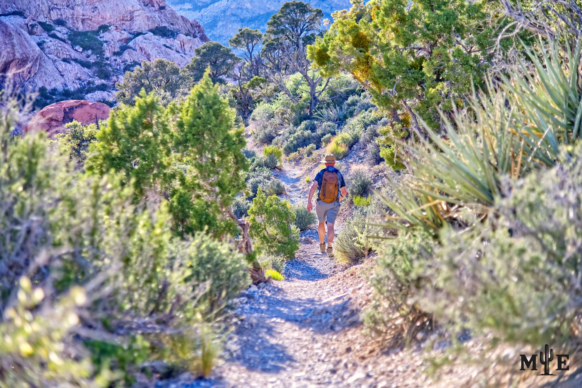
Las Vegas trails are far more diverse than the word “trail” suggests. Some are paved urban pathways with signs, bridges and regular maintenance. Others are official desert routes beginning at developed trailheads. Additionally, faint lines run through washes, old roads, summit approaches, animal paths or social trails created by repeated use. Understanding those differences is essential because a clear line on the ground does not always mean a route is official, safe or intended for public travel.
The most recognizable trail system lies at Red Rock Canyon National Conservation Area. Along the Scenic Drive, established trailheads reach Calico Hills, Sandstone Quarry, Calico Tanks, Turtlehead Peak, White Rock, Willow Spring, Ice Box Canyon, Pine Creek and Oak Creek. These routes receive heavy use and are generally mapped, but their conditions vary widely. A short nature trail can be followed by a boulder-filled canyon or a peak route with loose footing and substantial elevation gain.
Even on an official Red Rock trail, maintenance does not mean a smooth walking surface. Desert trails frequently cross stone slabs, gravel, sand and washes. Signs may mark the beginning and major junctions without guiding every turn. In places such as Ice Box Canyon, the established trail eventually gives way to travel over boulders. On summit routes, cairns and worn ground may indicate a direction but cannot replace navigation and judgment.
Beyond the Scenic Drive are large networks around Calico Basin, Blue Diamond Hill, Cottonwood Valley and the western edge of the city. Some trails were formally built for hiking, cycling or equestrian use. Others follow old roads, utility corridors, ranch routes or mining access. Connector trails developed because people needed to move between springs, canyons, ridges and neighboring travel corridors rather than return to the same starting point.
The Buckskin Cliff Shadows area illustrates how complicated the network can become. The open desert west and northwest of urban neighborhoods contains equestrian paths, mountain-bike routes, washes, utility tracks and numerous unnamed lines. Some are clear because local riders and hikers have used them for years. Others fade abruptly, split into multiple options or lead toward sensitive habitat and private or restricted land. A locally familiar route may have no official sign, maintenance schedule or published difficulty rating.
Social trails form when people repeatedly leave an established route. Sometimes the cause is harmless confusion at an unclear junction. In other cases, users cut switchbacks, seek a viewpoint, avoid mud or follow an appealing line toward a rock formation. One set of footprints encourages another until a visible path appears. These trails can fragment habitat, damage biological soil crust, cross cultural sites and make search-and-rescue work more difficult because the landscape contains too many competing lines.
Not every unofficial route is modern. Indigenous people traveled through the Las Vegas region for thousands of years, following water, seasonal food sources, hunting areas and passages through the mountains. Red Rock Canyon contains more than 40 springs and natural basins, which made it far more useful than surrounding dry terrain. Southern Paiute and earlier cultures moved across broad areas rather than living within the boundaries of modern parks. Some current paths may overlap portions of much older travel corridors, although it's rarely appropriate to claim a specific modern trail has a single origin without archaeological evidence.
Later routes were created or expanded by traders, ranchers, miners, surveyors, loggers and settlers. A path to a spring might've been used by wildlife first, then by Indigenous travelers, livestock and modern hikers. Old wagon roads and mine tracks sometimes became recreational connectors. In the Spring Mountains, logging roads and fire-management routes contributed to the network, while modern trail crews built sustainable alignments for hiking, cycling, horses or multiple uses.
Peak routes have another origin: the human desire to reach a high point. They often follow ridges, gullies or the least difficult break in a cliff rather than a historically practical travel corridor. These routes may be steep, exposed and lightly maintained. A summit trail can appear clearly worn near the bottom because thousands of people begin it, then become confusing where rock replaces soil and users spread across several possible lines.
Spring routes and canyon trails developed because water concentrates life and shade. First Creek, Pine Creek, La Madre Spring, Ash Spring and other water-influenced destinations draw visitors for the same basic reason people and animals have always used them. Yet seasonal water should never be treated as a dependable drinking source. Springs may be dry, contaminated or protected for wildlife. Desert hikers should carry all necessary water.
Las Vegas also has a substantial system of urban and suburban trails. The Bonanza Trail links parks and the Springs Preserve. Wetlands Park contains paved and natural-surface routes along the Las Vegas Wash. Summerlin incorporates neighborhood paths and paseos, while Henderson connects parks, washes and foothill access. These routes may lack the drama of a wilderness canyon, but they provide everyday recreation and help people understand the valley’s geography.
The safest way to approach any Las Vegas trail is to identify what kind of route it is before beginning. Look for the managing agency, official map, allowed uses, distance, elevation, seasonal restrictions and whether the path is maintained. Download navigation information in advance, but do not assume every user-created line on a mapping application is legitimate. Turn around when the route no longer matches the plan.
The clearly defined path in this photograph represents only one part of the region’s trail story. Las Vegas trails were built by agencies, communities and volunteers, but they were also shaped by water, wildlife, Indigenous movement, ranching, mining and the repeated choices of modern users. Some are destinations in themselves. Others exist because they connect one place of value to another. Together, they form a layered record of how people have moved through the desert as the network continues to grow.
Prints, Artwork and Licensing
This photograph is available for project-specific review as finished wall artwork and for appropriate editorial, commercial, hospitality, corporate, healthcare, or civic licensing. Final dimensions, cropping, materials, usage, production, and installation requirements are confirmed for each project.
Use the inquiry button above and reference ME-00395 so the exact image can be identified quickly.


