Las Vegas Nevada
Nevada: A State Built from Mountains
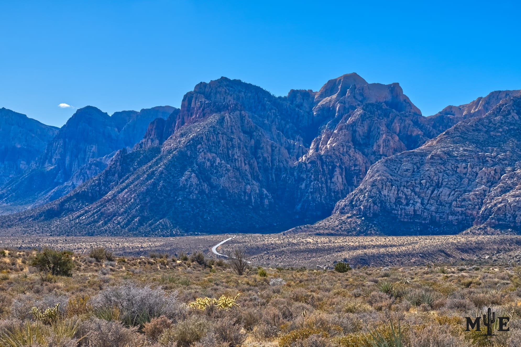
Nevada is commonly imagined as a flat desert crossed by long highways, but the state is overwhelmingly mountainous. From almost any broad valley, another range rises ahead, followed by another basin and another ridge beyond it. This repeated pattern is the defining landscape of the Basin and Range Province and one reason Nevada can contain scorching low deserts, snowy forests and alpine conditions within the same state.
Most Nevada ranges are relatively narrow and elongated, commonly running north to south with broad sediment-filled valleys between them. The pattern developed as the crust of western North America stretched. Large blocks of rock moved along normal faults: some blocks rose or tilted to form mountains, while neighboring areas dropped to form basins. Erosion then carried rock, gravel and sand from the growing ranges into the valleys, where deposits became thousands—and in some places tens of thousands—of feet thick.
This process is geologically recent and still active. The Nevada Bureau of Mines and Geology notes that nearly every range is bounded on at least one side by a fault that has been active during the last 1.6 million years. Earthquakes continue to adjust the landscape. Nevada is therefore not a collection of ancient mountains that finished forming long ago; it's a province still being pulled, faulted, tilted and eroded.
The north-south alignment is strongest across central and eastern Nevada because regional extension generally produced parallel faults and elongated blocks. Western Nevada becomes more complicated in the Walker Lane, a northwest-trending belt of strike-slip and normal faults near the California border. There, many ranges and valleys turn northwest as part of a broad zone accommodating motion between the Pacific and North American plates. The state’s mountain pattern is orderly from a distance but structurally complex on the ground.
The Sierra Nevada influenced Nevada profoundly, but it did not create most of the state’s interior ranges. The Sierra forms a massive western boundary and interacts with the Walker Lane, while Basin and Range faulting shaped most mountains farther east. Its greatest statewide influence is climatic. Pacific air rises over the Sierra and other California ranges, loses much of its moisture and descends into Nevada drier than before. That rain shadow helps make Nevada the nation’s driest state.
Elevation then produces dramatic local exceptions to the dryness. A low southern valley can exceed 110°F while a peak above it remains tens of degrees cooler. The Spring Mountains rise from roughly 3,000 feet to 11,918-foot Charleston Peak, passing from creosote desert through pinyon-juniper woodland, ponderosa pine and bristlecone forest to exposed summit terrain. Great Basin National Park warns that Wheeler Peak can be 20 to 30 degrees colder than the visitor center below. Snow can linger in high ranges well after valley spring has arrived, and mountain storms can bring lightning, hail or sudden temperature drops in summer.
Nevada’s highest natural point is Boundary Peak in the White Mountains along the California border. Its physically connected to the higher Montgomery Peak just across the state line, which is why some mountaineers regard Boundary as a subsidiary summit. Wheeler Peak in the Snake Range reaches 13,063 feet and is Nevada’s highest mountain located entirely within the state. Its surroundings include alpine terrain, ancient bristlecone pines, glacial features and Lehman Caves below.
The Ruby Mountains in northeastern Nevada provide one of the state’s most unexpected landscapes, with glacier-carved canyons, cirque basins and high lakes. The Toiyabe Range crosses central Nevada and carries the 62.7-mile Toiyabe Crest National Recreation Trail through country that includes Arc Dome Wilderness. The Spring Mountains dominate southern Nevada and provide the skyline west of Las Vegas. Mount Rose rises above the Reno–Tahoe area, while the Schell Creek, Toquima, Monitor, Egan, Santa Rosa and many other ranges create isolated watersheds and ecological islands.
These mountains govern more than scenery. They capture snow, feed springs and groundwater, direct rivers, create wildlife habitat and determine where towns, roads and rail lines can pass. Their mineral deposits shaped Nevada’s mining history. Their isolated elevations also allowed plant and animal populations to develop separately, producing endemic species found in only one range or small region.
The towering Spring Mountains in this photograph represent Nevada at its most characteristic. The desert floor appears open and low, but the wall above it contains a vertical sequence of climates and habitats. Nevada’s temperature range is not an accident added to the mountains; its created by them. The state’s fault-bounded ridges, deep basins and enormous elevation changes make it one of the most geologically legible and climatically varied landscapes in the United States.
Prints, Artwork and Licensing
This photograph is available for project-specific review as finished wall artwork and for appropriate editorial, commercial, hospitality, corporate, healthcare, or civic licensing. Final dimensions, cropping, materials, usage, production, and installation requirements are confirmed for each project.
Use the inquiry button above and reference ME-00379 so the exact image can be identified quickly.


