Telephoto
Clark County: The Government Behind Greater Las Vegas
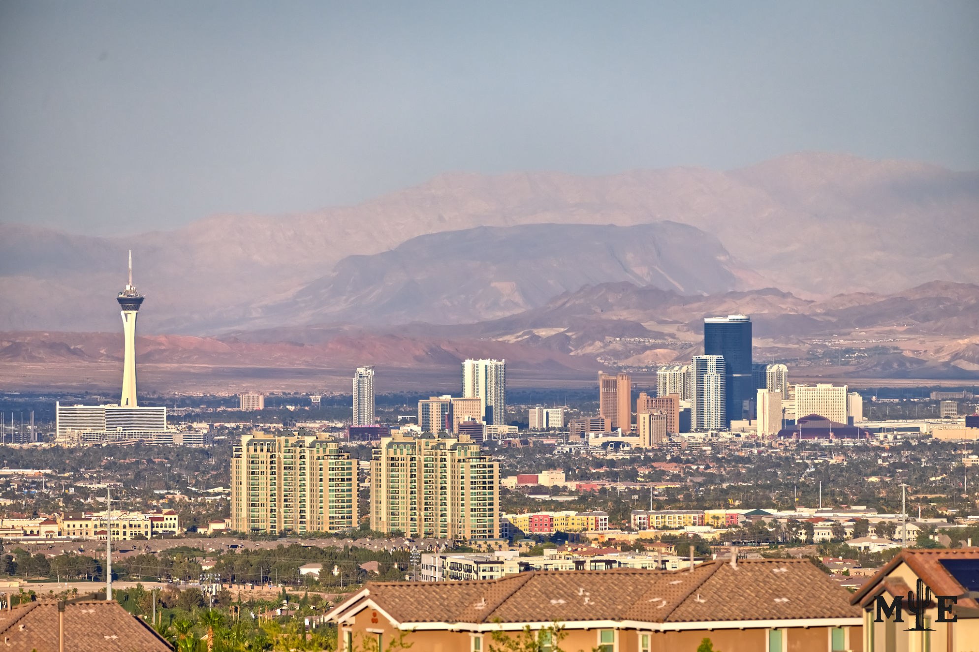
A view across rooftops, condominium towers and the distant Strip is an appropriate image for Clark County because most of greater Las Vegas is not one municipal city. The urban valley is divided among incorporated cities and large unincorporated communities, yet all are commonly described in conversation, mailing addresses and tourism advertising as “Las Vegas.” Clark County is the regional government connecting much of that landscape.
The county was formed in 1909 and named for Senator William Andrews Clark, whose railroad linked Southern California with Salt Lake City and helped establish Las Vegas as a railroad town. Las Vegas is the county seat. Clark County now covers approximately 8,061 square miles, extending far beyond the metropolitan basin into desert, mountains and communities along the Colorado River. It's Nevada’s most populous county and contains most of the state’s residents.
The U.S. Census Bureau estimated the county population at 2,407,226 in 2025, up roughly 6.2 percent from the 2020 base. That figure is dramatically larger than the City of Las Vegas population because it also includes Henderson, North Las Vegas, Boulder City, Mesquite and extensive unincorporated areas. Most residents live in the Las Vegas Valley, but the county also includes places such as Laughlin, Searchlight, Moapa Valley, Indian Springs, Goodsprings and rural desert settlements.
The incorporated cities have their own elected governments and municipal departments. Unincorporated towns and neighborhoods do not. Paradise, Winchester, Spring Valley, Enterprise, Sunrise Manor and other communities are administered through Clark County even though their addresses may say Las Vegas. Most of the world-famous Strip lies in the unincorporated towns of Paradise and Winchester rather than inside the City of Las Vegas. This distinction affects planning, fire protection, business licensing, courts and which elected body makes local decisions.
Clark County provides both neighborhood-level and regional services. For roughly one million residents of unincorporated areas, it performs functions that a city government would normally handle, including land-use planning, parks, roads, building oversight and fire protection. Countywide or regional responsibilities include Harry Reid International Airport, air-quality management, social services, the court system, University Medical Center and major recreation facilities. The Las Vegas Metropolitan Police Department is jointly connected to the county and City of Las Vegas rather than functioning as a conventional county sheriff’s office alone.
The county’s geography is far more varied than the skyline suggests. Its boundaries include parts of Lake Mead National Recreation Area, the Colorado River corridor, agricultural land in Moapa Valley, high desert, dry lake beds and mountain ranges. Tourism and casino resorts are globally visible, but county government must also maintain roads, emergency response and public services across sparsely populated terrain. A policy appropriate for the Strip may have little relevance to a rural resident living more than an hour from central Las Vegas.
Understanding Clark County also prevents common errors when describing local places. A business near the Strip can use “Las Vegas” in its postal address without paying City of Las Vegas taxes or receiving city services. Summerlin crosses jurisdictional ideas because portions are within the city while neighboring west-valley areas are not. Spring Valley is a county-administered town, and Henderson and North Las Vegas are independent cities rather than Las Vegas neighborhoods. The metropolitan area functions as one economy, but it's not one government.
The north Strip towers in this photograph attract the eye, yet the homes in front tell the more complete story. Clark County is not simply the governmental label attached to casino resorts. It is the framework serving more than 2.4 million people whose daily lives unfold in subdivisions, apartment communities, cities, rural towns and desert landscapes spread across one of the nation’s largest counties.
Prints, Artwork and Licensing
This photograph is available for project-specific review as finished wall artwork and for appropriate editorial, commercial, hospitality, corporate, healthcare, or civic licensing. Final dimensions, cropping, materials, usage, production, and installation requirements are confirmed for each project.
Use the inquiry button above and reference ME-00393 so the exact image can be identified quickly.


